


This month's walk: A circular walk around Hawkshead
Source: georgefisher.co.uk
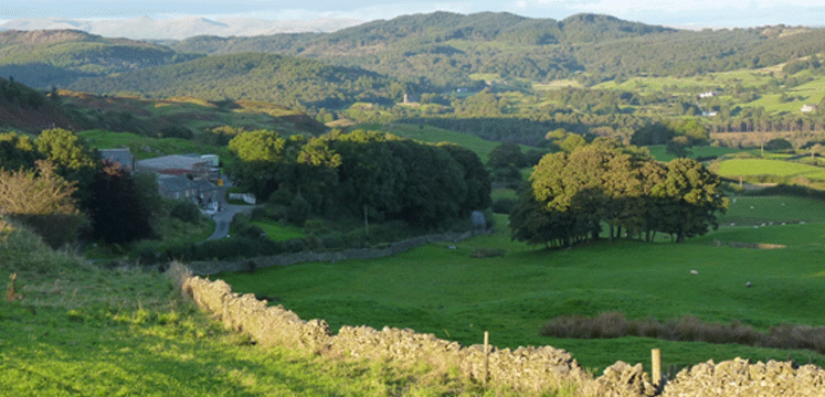
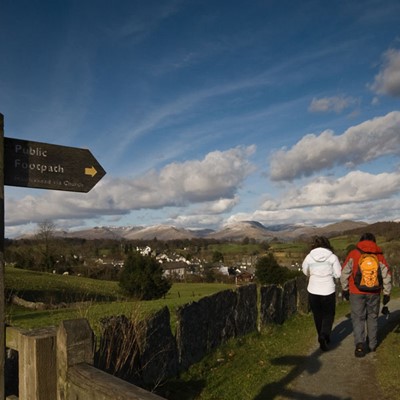
A circular, full-day woodland walk exploring the forests around Hawkshead and Near Sawrey, where Beatrix Potter's house is found. It's low-level, but there is a bit of navigation to be done among the forest tracks. It's hard to get very lost, though. There is a little bit of road walking, but this should be a suitable walk for most well-trained families.
Loop or linear? Loop
Map: OS Explorer Map: OL7 - The English Lakes (SE area)
Total distance: 15.2km (9.4 miles)
Total height gain: 429m (1,409ft)
Start: Hawkshead, OS Grid: SD351983
Unsuitable for: buggies, wheelchairs
Public transport: Bus 505, the Coniston Rambler, runs from Kendal and Ambleside
1. Hawkshead OS Grid: SD351983
Start in the village centre, at the bus stop.
2. Vicarage Lane OS Grid: SD348981
0.3 km (roughly 0.2 miles) from 1
From the village centre, head along Vicarage Lane.
3. Bridleway OS Grid: SD343977
0.6 km (roughly 0.4 miles) from 2
At the end of the road, a bridleway leads into the northern reaches of Grizedale Forest. Follow this to join a forest track.
4. Hawkshead Moor OS Grid: SD339968
1 km (roughly 0.6 miles) from 3
The trail climbs gently through the forest, meeting the cycle trails that cross through Grizedale.
5. Great Coppice OS Grid: SD345958
1.2 km (roughly 0.7 miles) from 4
Cross the road and continue south along the bridleway through the forest.
6. Junction OS Grid: SD345952
0.6 km (roughly 0.4 miles) from 5
At the junction of paths, take the downhill route to your left.
7. At the road OS Grid: SD357954
1.2 km (roughly 0.8 miles) from 6
When you meet the road, turn left then immediately right along the end of Esthwaite Water.
8. Near Sawrey OS Grid: SD369956
1.2 km (roughly 0.8 miles) from 7
Beyond the lake, you reach Near Sawrey. Stop at the Tower Bank Arms for a drink if you are thirsty.
9. Moss Eccles Tarn OS Grid: SD372967
1.1 km (roughly 0.7 miles) from 8
The bridleway heading north from the village will lead you to Moss Eccles Tarn.
10. Wise Een Tarn OS Grid: SD372976
0.9 km (roughly 0.5 miles) from 9
Continue heading uphill past Wise Een Tarn then into the woods around Claife Heights.
11. Long Heights OS Grid: SD375986
1 km (roughly 0.6 miles) from 10
A bit of tricky navigation through the woods here; you need to follow the paths to a four-way junction. Turn left here, then immediately pick up the footpath going uphill.
12. Latterbarrow OS Grid: SD367991
0.9 km (roughly 0.6 miles) from 11
Enjoy the views over Hawkshead and Esthwaite Water from Latterbarrow.
13. Colthouse OS Grid: SD359985
1 km (roughly 0.6 miles) from 12
Descending from Latterbarrow, turn left at the road to pass through the hamlet of Colthouse.
14. Hawkshead again OS Grid: SD353980
0.8 km (roughly 0.5 miles) from 13
Follow the road back to Hawkshead village.
Source: georgefisher.co.uk
Date: 03 Jan 2017